The future uses of UAV in agriculture
24 June 2015The news recently has had numerous articles of the use (and mis-use) of UAV (unmanned aerial vehicles). Commonly referred to as ‘drones’, UAV are now used in many industries, as well as increasingly used out of simple interest or for recreation activities. Land management is no different, and UAV are now used in many applications, with the potential for much more use in the future.
The increased use and availability of UAV has been driving by technological development, coupled to reducing costs and ease of access to the technology. A few hundred pounds can purchase a ready-to-fly UAV, whilst a more advanced UAV may cost tens of thousands of pounds. Within the land management field there are many possible applications of UAV. For example, simple aerial images or video footage of crops could allow managers to identify areas of poor growth. More advanced analysis include the use of multi-spectral images that may be able to detect plant stress (e.g. nutrient deficiency, drought, disease) earlier, and the results could be linked to GPS-enabled treatments such as fertiliser or pesticide/herbicide application. Interest from hill farmers has focused on the ability to use UAV to check animals, for example a UAV could survey several hillsides very quickly by watching live video from the UAV on a smartphone or tablet. It is even possible for the images generated to be processed to allow automatic counting of animals. UAV may also be used to check infrastructure, for example inspecting the roofs of buildings, surveying for field drainage issues or for security inspection. Further diverse applications include the ability to inspect trees, monitor invasive species, light payload delivery and wildlife surveying.
Needless to say, UAV are not a simple tool that will address all the above issues easily. UAV must be used in line with the CAA regulations (see below) which may require licensing for commercial purposes, which involves training and assessment. UAV are also limited by weather, so rain and high wind-speeds will restrict the possible window of use. Nonetheless, UAV are increasingly used by land management researchers, consultants, and are attracting the interest of individual managers. SRUC is researching and developing UAV capability, along with the ability to process the data gathered effectively. As part of that work, we are keen to understand what tasks land managers would like to see UAV perform, either through SAC Consultancy, or by use of their own UAV.
We would be grateful if you could take the time to complete the survey at the link below – this survey contains example images and aerial footage from SRUC UAV flights as examples.
SRUC/SAC survey of potential applications of UAV
Sample CAA regulations
• For commercial operations, requires the farmer or other competent and TRAINED person with CAA approval, to have direct, unaided visual contact with the aircraft sufficient to monitor its flight path in relation to other aircraft, persons, vehicles, vessels and structures for the purpose of avoiding collisions (up to a max of 500m). For a farmer using it within own boundaries, CAA approval may not be required.
• They cannot fly within 50 metres of any vessel, vehicle or structure which is not under the control of the person in charge of the aircraft.
• over or within 150 metres of an organised open-air assembly of more than 1,000 persons
• over or within 150 metres of any congested area
• DATA PROTECTION ACT applies for all images gathered (that may include individuals).
• Height must be less than 400 feet legally.
• Weight limit normally 7 kg including aircraft/fuel/batteries, as this avoids air traffic control restrictions.
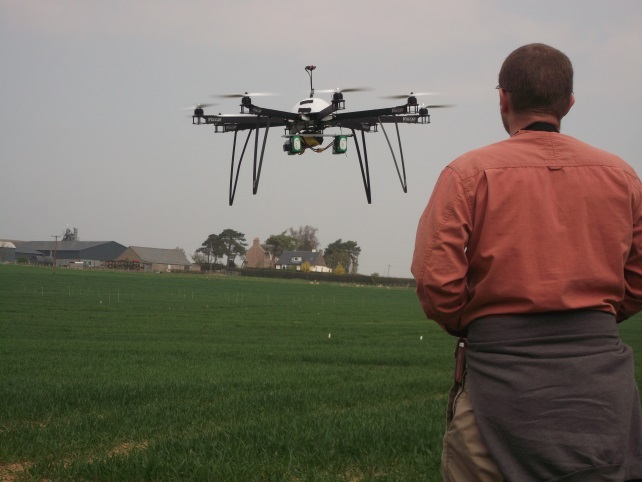
SRUC PhD researcher Simon Gibson-Poole and a quadcopter (8 rotor) UAV.
Alistair Hamilton, Academic Teaching, SRUC
Sign up to the FAS newsletter
Receive updates on news, events and publications from Scotland’s Farm Advisory Service